יום חמישי, י״ד אלול תשפ״וThursday, August 27, 2026



Follow Us


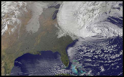
NOAA's GOES-13 satellite captured this visible image of Hurricane Sandy battering the U.S. East coast on Monday, Oct. 29 at 9:10 a.m. EDT. At 8 a.m. EDT the National Hurricane Center noted that the center of Hurricane Sandy was located near latitude 36.8 north and longitude 71.1 west. This was about 310 miles (505 km) […]
 August 21, 2026